The Great Zimbabwe city was built between the 12th and the 16th Century AD.

It was a city with an economy based on trade, mainly Gold, ivory and livestock.
It can still be viewed today from Google maps.
Below is the link to the google map cordinates.
https://maps.google.co.ke/maps?q=great+zimbabwe+history&ll=-20.272634,30.934963&spn=0.002843,0.005284&t=h&z=18

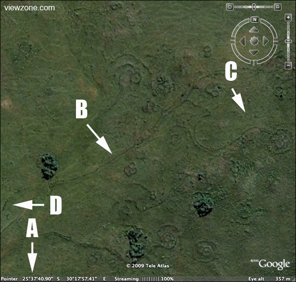
From the aerial view, the planning was superb. There was the main building which was linked to several other buildings through well defined roads.
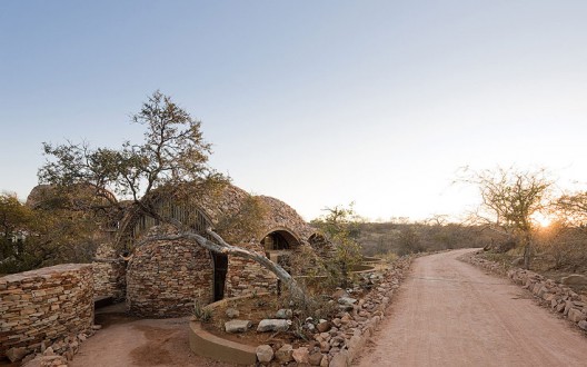
The walls were curvilinear in shape and were constructed using stone.
To shape stone as the Zimbabweans did, this means they had a good metal fabrication industry that could produce various chisels for this work.
Also, to mine the gold and purify it, the Zimbabwean must have had very good metallurgy skills.
Use of Gold as currency means that the early understanding of trade and economics was perfect.
The current economic situation is abit on the lower side since till today, the US Dollar is still not backed by gold, hence has a value only on its paper worth based on what agreements have been made to represent value.
Extension to South Africa.
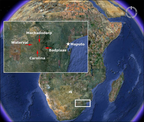
The link below is for a Google map of similar ancient cities near Swaziland with the same architecture as the Great Zimbabwe.
Kingdom of Mapungubwe.1100 to 1300 AD.

The Kingom of Mapungubwe, in South Africa, also constructed using stone on a similar architectural planning.
http://en.wikipedia.org/wiki/Kingdom_of_Mapungubwe
Here is the google map
https://maps.google.co.ke/maps?q=kingdom+of+mapungubwe&ll=-22.213788,29.392891&spn=0.17958,0.338173&hnear=Mapungubwe&t=h&z=12


https://maps.google.co.ke/maps?q=25+55’+53.28%22+S+%2F+30+16’+13.13%22+E&ll=-25.931963,30.270461&spn=0.002726,0.005284&t=h&z=18
This could mean that the Great Zimbabwe civilisation covered a very huge area, with Great Zimbabwe as its epicentre, with a radius of thousands of kilometers.
Here are other remains of a similar city in Baadplus, South Africa.

https://maps.google.co.ke/maps?q=25+47’+33.45%22+S+%2F+30+40’+38.76%22+E&ie=UTF8&ll=-25.792861,30.677621&spn=0.001364,0.002642&hnear=33,+Canc%C3%BAn,+Quintana+Roo,+Mexico&t=h&z=19
https://maps.google.co.ke/maps?q=25+38’+07.82%22+S+%2F+30+21’+18.79%22+E&ll=-25.635897,30.356426&spn=0.005465,0.010568&t=h&z=17
This city near Emgwenya, South Africa, has its interlinking roads in between the various smaller cities clearly visible on google maps.
https://maps.google.co.ke/maps?q=25+39’+22.42%22+S+%2F+30+17’+03.25%22+E&ll=-25.656353,30.283991&spn=0.002732,0.005284&t=h&z=18
Kenyan pre colonial villages.
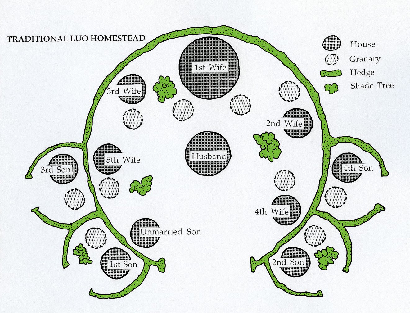
Most Kenyan pre colonial villages shared the same planning whereby the outer boundary was curvilinear and the buildings were circular in nature.
The difference comes in use of materials in that adobe mud was used for walling while the Zimbabwe villages used stone for walling.

Iron Age.
In Africa, ancient Africans moved from using stone tools to iron directly without the copper and bronze stage. In other parts of the world, there was a gradual shift from stone age to copper,bronze then iron except in Africa. Copper and Bronze are easier to extract , purify and mould into shape, compared to iron, which is more complex.
http://en.wikipedia.org/wiki/Iron_Age
In Nigeria, iron smelting was already in place in the 6th century BC.
http://en.wikipedia.org/wiki/Nok_culture
The ability to make iron tools was then implemented in making farm tools used to clear forests , dig and plant crops . This was spread from Nigeria to the rest of Africa and the world through the migrating Bantu communities.
Norhtern Tanzania , in particular, had very complex iron smelting furnaces that could produce high quality steel in the ancient times.
http://link.springer.com/article/10.1007%2FBF01117455#page-1
The Chifumbanze people are responsible for the rapid spread of iron smelting technology in Africa. They started from West Africa to South Africa and finally to East Africa. They had a liking for trade, farming and living in hilly areas. They are also responsible for construction of the Great Zimbabwe city.
Use of iron tools to arm themselves from invaders also ensured the early African civilisations protected themselves from slave trade.

Conclusion.
Use of iron tools within the construction industry aided the ancient Bantu people to construct using stone. Variuos iron mongery such as door locks, door hinges etc were also incorprated into the building. Also, most doors were meticulously curved into interesting patterns using steel tools.
Cities such as the Great Zimbabwe were constructed in the 12th century AD, just after discovery of steel in Africa. Bantu migration was also active after the steel discovery.
http://www.hamillgallery.com/EXHIBITIONS/AfricanDoors.html
Francis Gichuhi Kamau, Architect.
info@architect.com


Leave a Reply